

 eTyphoonImg
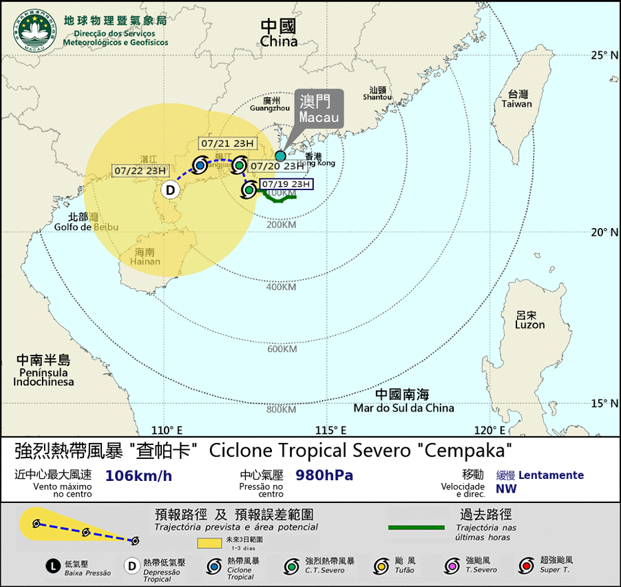
Possible warning signals to be issued due to the impact on "Cempaka"
Update Time: 2021-07-19 23:45
| Signals | Forecast Period | Probability |
| Typhoon Signal No.3 | In effect | |
| Typhoon Signal No.8 | Between dawn and morning on 20th | Medium to relatively high |
| "blue" Storm Surge Warning | In effect | |
| "yellow" Storm Surge Warning | Low | |
Severe tropical Storm Cempaka was intensifying and moving more westward in the past few hours. Due to its circulation is small and the movement is slow, the chance of issuing typhoon signal No. 8 before the dawn on 20th is low, unless it intensifies significantly or accelerate its approach to Macao, However, since Cempaka will intensify further and will be the closest to Macau tomorrow daytime, the chances of issuing typhoon signal No. 8 from dawn to morning tomorrow remains "Medium to relatively high". Our bureau will monitor the development of Cempaka closely.
Under the influence of Cempaka and heavy rain, flooding about 0.5m is expected over the low-lying area of Inner Harbour Area. Blue Storm Surge Warning is still in effect. The public in the low-lying area should be aware.
Remarks: The probabilities of issuing severe weather warning signals for the next one or two days are provided in the table. Public can learn the possibility of being affected by the tropical cyclone over the specific period of time in Macao so that necessary precautions can be well prepared earlier. Please keep notice of our latest information.