 eTyphoonImg
Possible warning signals to be issued due to the impact on "Kompasu"
Update Time: 2021-10-12 17:15
| Signals | Forecast Period | Probability |
| Typhoon Signal No.3 | In effect | |
| Typhoon Signal No.8 | Between 8 p.m. and 11 p.m. tonight | High |
| "blue" Storm Surge Warning | In effect | |
| "yellow" Storm Surge Warning | Relatively low | |
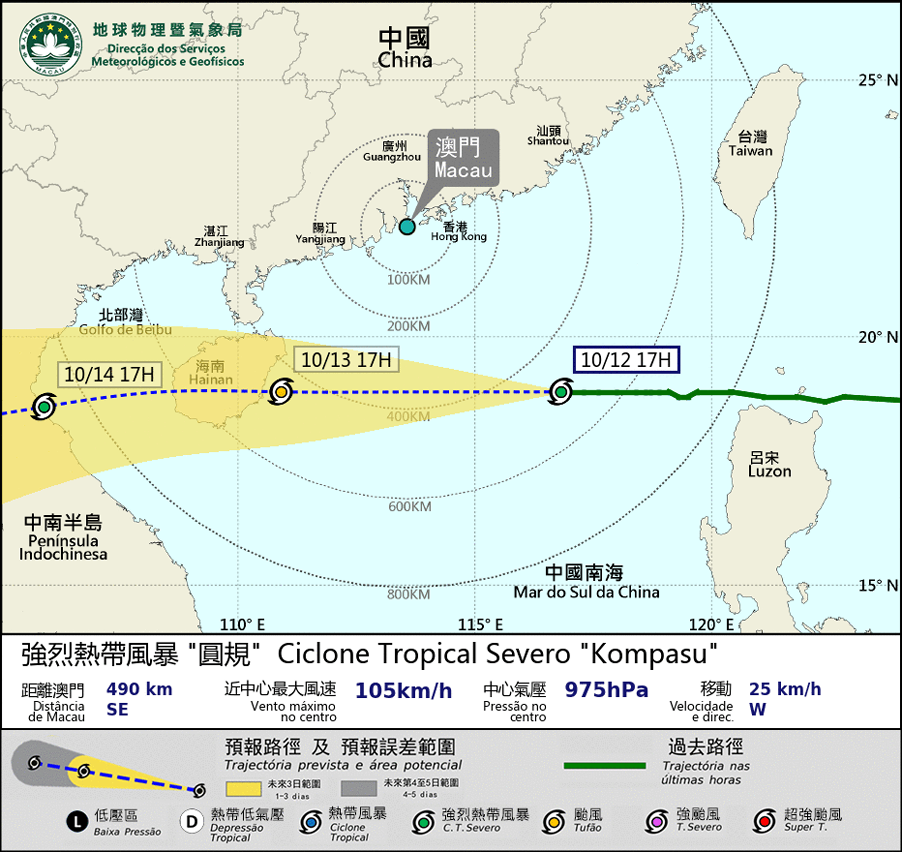
Kompasu is intensifying gradually. It will move across the northern part of the South China Sea in these two days, and come closest to Macao between midnight and morning on the 13th, at a distance of around 400km south to Macao. It will move in the general direction to the Hainan.
Under the joint influence of Kompasu and northeast monsoon, the local weather will become unsettled tonight and tomorrow, with heavy, frequent showers and thunderstorms. Winds, northeasterly to easterly, will reach wind force level 8 – 9, with gusts. SMG will consider to issue the No.8 signal between 8 p.m. and 11 p.m. tonight.
Meanwhile, under the joint effect of storm surge and high astronomical tide, flooding is expected in inner-harbor areas between 9 p.m. tonight and 5 a.m. tomorrow, with flooding levels below 0.5m. The public is advised to pay close attention to the latest weather information and take precautions against strong winds and flooding.
Remarks: The probabilities of issuing severe weather warning signals for the next one or two days are provided in the table. Public can learn the possibility of being affected by the tropical cyclone over the specific period of time in Macao so that necessary precautions can be well prepared earlier. Please keep notice of our latest information.


