

 eTyphoonImg
Possible warning signals to be issued due to the impact on "Kompasu"
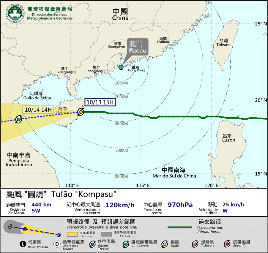
Update Time: 2021-10-13 15:00
| Signals | Forecast Period | Probability |
| Typhoon Signal No.8 | In effect | |
| "blue" Storm Surge Warning | In effect | |
Typhoon “Kompasu” keeps moving westward and will land on Hainan Island soon. As "Kompasu" is moving away, Macau will unlikely have strong wind. SMG will consider changing to Tropical Cyclone Warning Signal No.3 between 5 pm and 8 pm. However, as Macau is still affected by the circulation of "Kompasu", Macau will still have showers and thunderstorms in the next few hours.
In addition, the Inner Harbour area is unlikely to have flooding again in the daytime. However, due to the effect of strong easterly wind and high astronomical tide height on the 13th night, the Inner Harbour area is expected to have flooding, with flooding levels below 0.5 m, between 9 pm 13th and 4 am 14th. The public is advised to pay close attention to the latest weather information.
Remarks: The probabilities of issuing severe weather warning signals for the next one or two days are provided in the table. Public can learn the possibility of being affected by the tropical cyclone over the specific period of time in Macao so that necessary precautions can be well prepared earlier. Please keep notice of our latest information.