

 eTyphoonImg
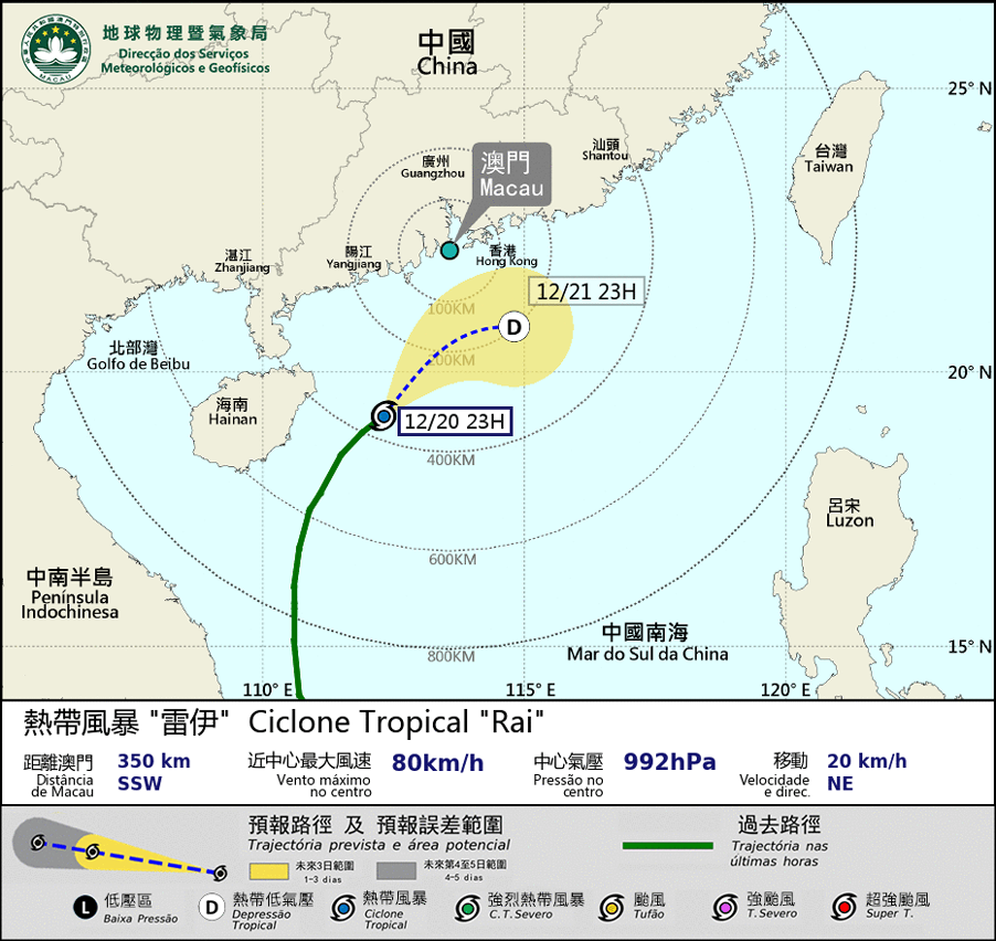
Possible warning signals to be issued due to the impact on "Rai"
Update Time: 2021-12-20 23:20
| Signals | Forecast Period | Probability |
| Typhoon Signal No.1 | In effect | |
| Typhoon Signal No.3 | Between midnight and early morning | Medium |
| "blue" Storm Surge Warning | In effect | |
Tropical cyclone “Rai” weakened into Tropical Storm and is expected to pass within 200 km south of Macao during the midnight to early morning. The rain band associated with “Rai” will affect Macao at the beginning of day 21 with frequent rain. Although “Rai” has weakened further, it will be nearest to Macao between the early morning and the morning of day 21. Winds are expected to strengthen, reaching force 6 occasionally with gusts. The bureau will consider whether it is necessary to issue Tropical cyclone signal No.3 between the early morning and morning. Public is advised to pay close attention to the weather change and the latest storm news.
“Blue” Storm Surge Warning is still in effect. Under the influence of continuous rain, flooding is expected in low-lying area during the midnight. Public is advised to take precautions against flooding.
Remarks: The probabilities of issuing severe weather warning signals for the next one or two days are provided in the table. Public can learn the possibility of being affected by the tropical cyclone over the specific period of time in Macao so that necessary precautions can be well prepared earlier. Please keep notice of our latest information.