

 eTyphoonImg
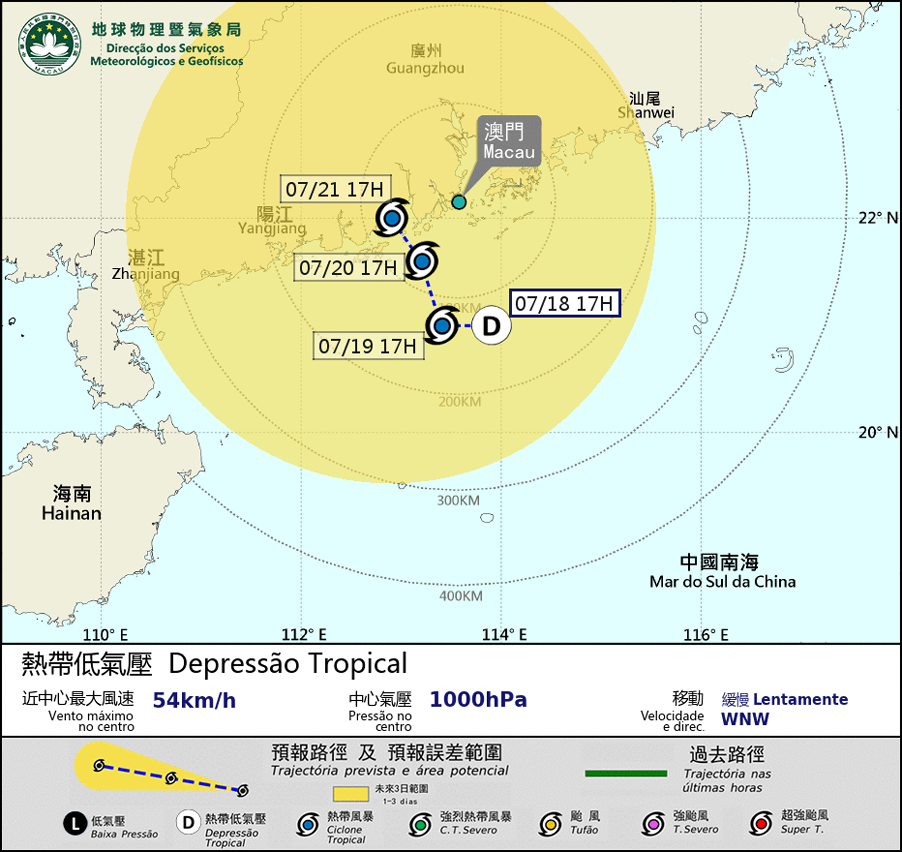
The probabilities of issuing severe weather warning signals
Update Time: 2021-07-18 18:00
| Signals | Forecast Period | Probability |
| Typhoon Signal No.1 | In effect | |
| Typhoon Signal No.3 | Between dawn and morning on 19th July | Medium |
| "blue" Storm Surge Warning | 19th and 20th | Low |
The low pressure area over the northern part of the South China Sea has intensified into a tropical depression. Although the circulation of the tropical cyclone is relatively small, it is expected to linger within 200 km south of Macao and may further intensify in the next two or three days. Its related rainband will bring unsettled weather to Macao, with heavy showers and the winds will strengthen in the next few days. The development of the tropical cyclone will be closely monitored. Meanwhile, as it will not be in the high phase of astronomical tide on 19th and 20th , the possibility of storm surge will be low, the public should pay attention to the latest weather information.
Remarks: The probabilities of issuing severe weather warning signals for the next one or two days are provided in the table. Public can learn the possibility of being affected by the tropical cyclone over the specific period of time in Macao so that necessary precautions can be well prepared earlier. Please keep notice of our latest information.