

 eTyphoonImg
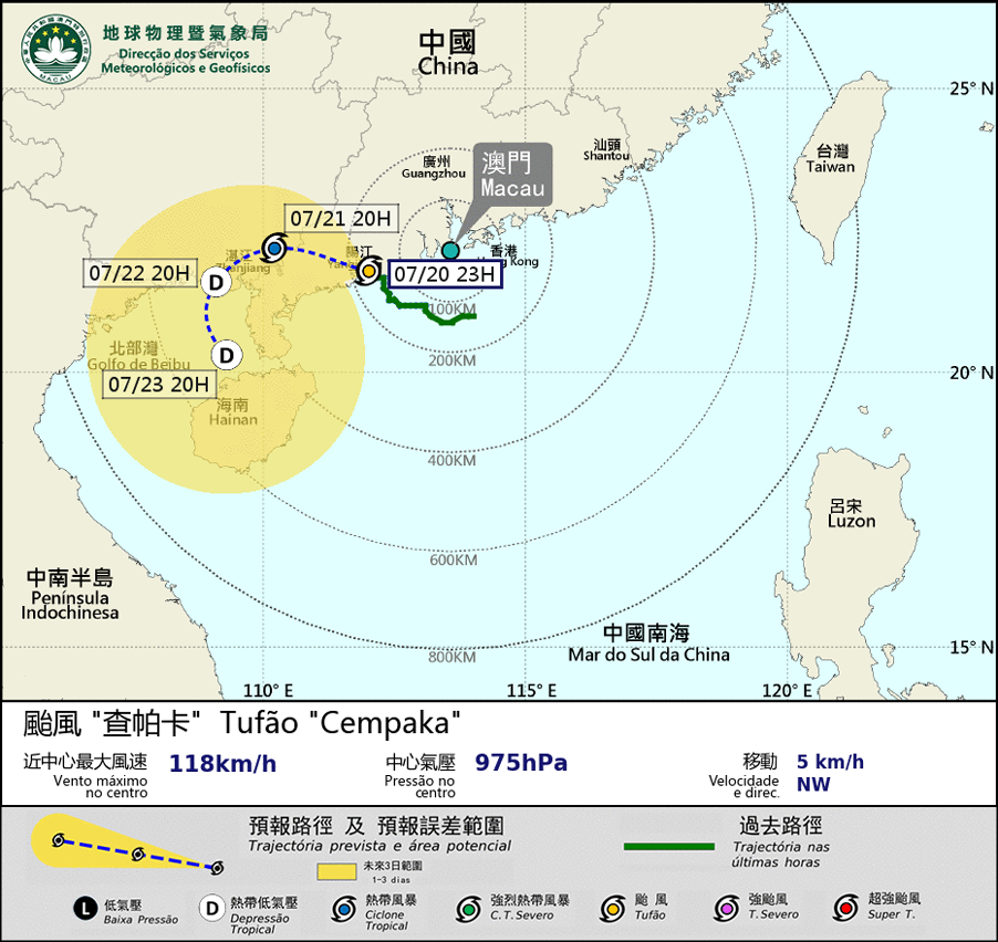
Possible warning signals to be issued due to the impact on "Cempaka"
Update Time: 2021-07-20 23:00
| Signals | Forecast Period | Probability |
| Typhoon Signal No.1 | In effect | |
Typhoon Cempaka has made landfall on Yangjiang. The wind speed in Macao has weakened during the past several hours. As long as it weakens and further moves away from Macao the chance of being affected by strong winds in Macao becomes less. Tropical Cyclone Warning Signal No.1 has been issued. Yet, Cempaka will still linger around the west coast of Guangdong in the next two or three days and the track of Cempaka is still uncertain. Affected by its related outer rainbands the weather in Pearl River Delta will be unstable in the next one or two days. Occasional strong winds and thundery showers are still expected in Macao. The public is advised to stay alert and pay attention to the latest storm news.
Remarks: The probabilities of issuing severe weather warning signals for the next one or two days are provided in the table. Public can learn the possibility of being affected by the tropical cyclone over the specific period of time in Macao so that necessary precautions can be well prepared earlier. Please keep notice of our latest information.