

 eTyphoonImg
The probabilities of issuing severe weather warning signals
Update Time: 2021-08-03 05:00
| Signals | Forecast Period | Probability |
| Typhoon Signal No.1 | In effect | |
| Typhoon Signal No.3 | Between nighttime on 3rd and early morning on 4th | Relatively low to medium |
| "blue" Storm Surge Warning | Low | |
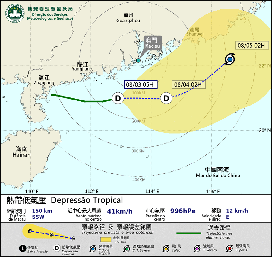
The tropical depression is now located near the western coast of Guangdong. It is forecasted to intensify and move eastwards towards the northern part of the South China Sea, bringing unsettled weather to the coast of Guangdong. Occasional heavy showers and thunderstorms are expected in Macao, and winds will intensify with gusts. The tropical depression will move closest to Macao between nighttime on 3rd and early morning on 4th. As its track is still uncertain, members of the public are advised to pay close attention to the change in weather and the latest tropical cyclone information.
Besides, as it is not during the high phase of the astronomical tide in the next few days, the possibility of storm surge flooding is low. However, the public should still be alert to flooding owing to heavy rain.
Remarks: The probabilities of issuing severe weather warning signals for the next one or two days are provided in the table. Public can learn the possibility of being affected by the tropical cyclone over the specific period of time in Macao so that necessary precautions can be well prepared earlier. Please keep notice of our latest information.