

 eTyphoonImg
The probabilities of issuing severe weather warning signals
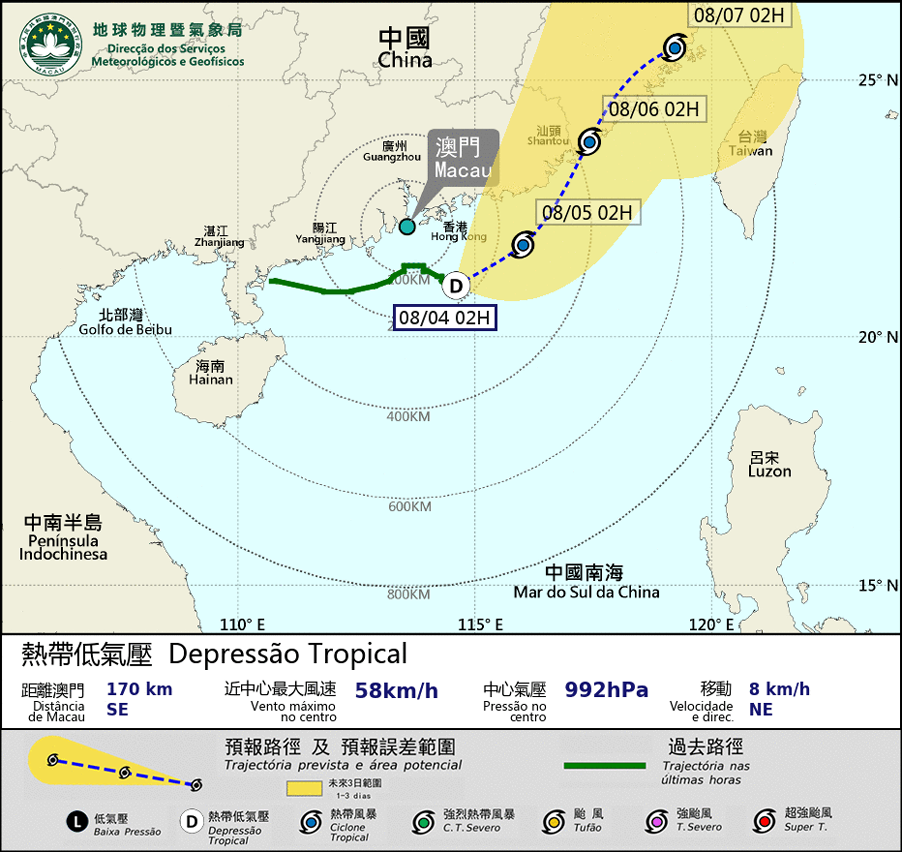
Update Time: 2021-08-04 02:15
| Signals | Forecast Period | Probability |
| Typhoon Signal No.3 | In effect | |
The tropical depression in the sea area southeast of the Pearl River Estuary is moving away from Macao and is generally moving towards the eastern coast of Guangdong. As the tropical depression moves further away from Macao, the possibility of Macao being affected by strong winds will be lower, SMG will consider issuing Tropical Cyclone Warning signal No.1 in the next few hours. However, affected by its outer circulation, occasional heavy showers and thunderstorms are still expected in Macao, the winds over the bridges are expected to be fresh and gusty. The public is advised to pay close attention to the change in weather, the latest storm news and also the possibility of flooding caused by heavy rains.
Remarks: The probabilities of issuing severe weather warning signals for the next one or two days are provided in the table. Public can learn the possibility of being affected by the tropical cyclone over the specific period of time in Macao so that necessary precautions can be well prepared earlier. Please keep notice of our latest information.