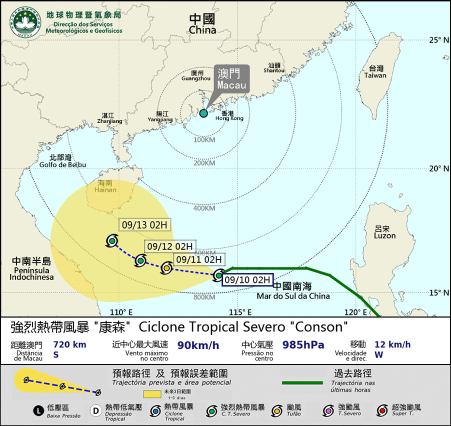
 eTyphoonImg
Possible warning signals to be issued due to the impact on "Conson"
Update Time: 2021-09-10 05:00
| Signals | Forecast Period | Probability |
| Typhoon Signal No.1 | In effect | |
| Typhoon Signal No.3 | Daytime on 10th | Relatively low |
| "blue" Storm Surge Warning | Low | |
Severe Tropical Storm Conson is forecasted to move westwards across the South China Sea. It will move towards the vicinity areas of Hainan island. Since Conson will keep a distance of 600 km away from Macao, the possibility of issuing higher tropical cyclone signals is relatively low unless it moves towards a more northern track than expected or intensifies rapidly. Besides, Super Typhoon Chanthu over the northwest Pacific will move in the general direction of Taiwan. Since it is not in the high phase of the astronomical tide in the next few days and the tropical cyclones keep a distance from Macao, it is unlikely to have storm surge flooding.
Under the influence of the outer subsiding airs of tropical cyclones, it is forecasted to be partly sunny and very hot during this coming weekend in Macao, as well as hazy during the daytime. However, high temperatures may induce a few showers and thunderstorms in the afternoon. The public are advised to pay close attention to the weather change and the latest tropical cyclone news.
Remarks: The probabilities of issuing severe weather warning signals for the next one or two days are provided in the table. Public can learn the possibility of being affected by the tropical cyclone over the specific period of time in Macao so that necessary precautions can be well prepared earlier. Please keep notice of our latest information.


