 SMG.gif
The probabilities of issuing severe weather warning signals
Update Time: 2021-10-07 19:00
| Signals | Forecast Period | Probability |
| Typhoon Signal No.1 | In effect | |
| Typhoon Signal No.3 | Early morning to morning on 8th | Medium to relatively high |
| Typhoon Signal No.8 | Relatively low | |
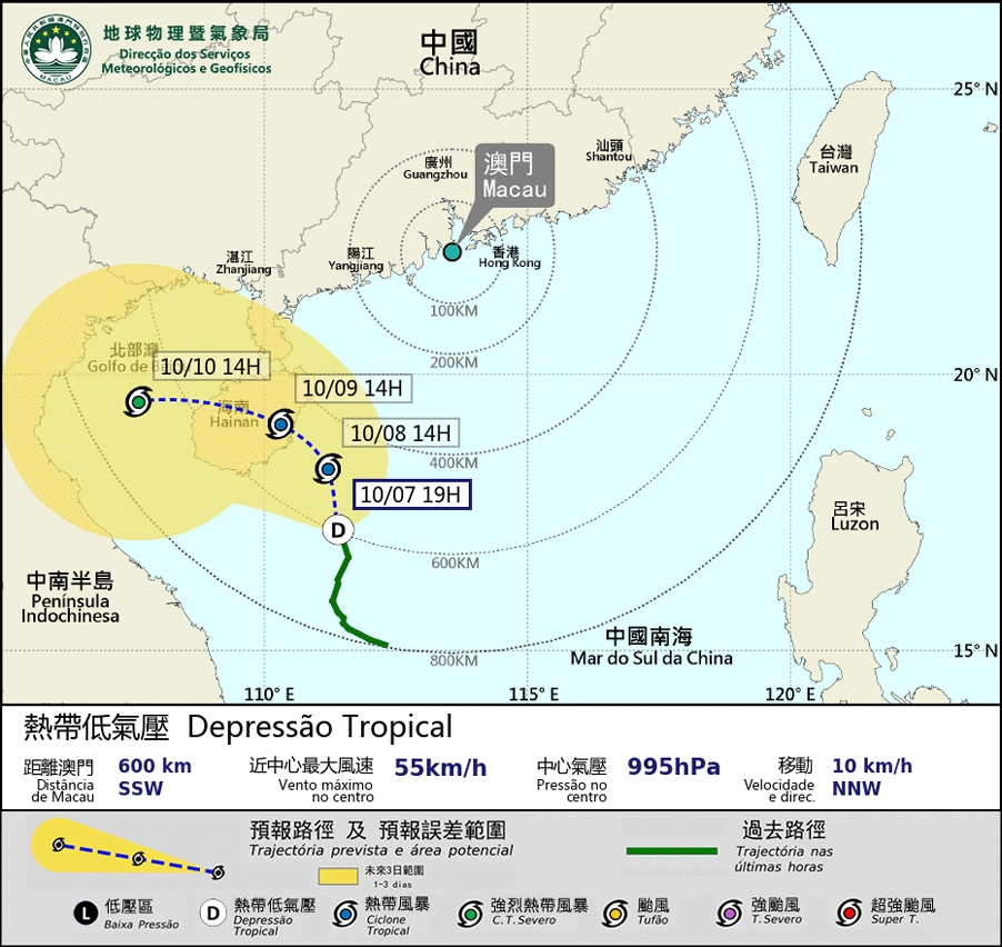
The tropical depression over the northern part of the South China Sea is developing a new center southeast of the Hainan Island, within its broad circulation. It will become more closer to Macao than previously expected, passing through at a distance of about 400 km southwest of Macao, move generally towards the area between Hainan Island and the Leizhou Peninsula in the next few days. Under the combined influence of the tropical depression and the northeast monsoon, the weather in Macao will become unsettle starting from Friday, winds in Macao will intensify with occasional heavy showers. As it is during the high phase of astronomical tide, flooding will occur in the inner harbor area in the next few days.
Meanwhile, another low pressure area is developing over the Western Pacific, at the east of the Philippines. It is expected to move towards the Luzon Strait at the beginning of next week. SMG will closely monitor its latest situation, the public is advised to pay attention to the latest weather news.
Remarks: The probabilities of issuing severe weather warning signals for the next one or two days are provided in the table. Public can learn the possibility of being affected by the tropical cyclone over the specific period of time in Macao so that necessary precautions can be well prepared earlier. Please keep notice of our latest information.


