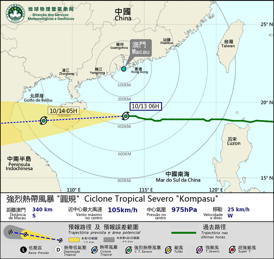
 eTyphoonImg
Possible warning signals to be issued due to the impact on "Kompasu"
Update Time: 2021-10-13 07:00
| Signals | Forecast Period | Probability |
| Typhoon Signal No.8 | In effect | |
| Typhoon Signal No.9 | Relatively low | |
| "blue" Storm Surge Warning | In effect | |
| "yellow" Storm Surge Warning | Relatively low | |
“Kompasu” has intensified to a typhoon this morning. "Kompasu" is moving across the South of Macau, at a distance of around 340 km, and affect Macau significantly in the next few hours. Showers will be more frequent and winds will intensify significantly. The maximum wind will reach wind force level 8 – 9, with gusts. The wind direction will change to northeasterly first, then change to easterly. The public should pay attention to the change in the prevailing wind direction. “Kompasu” is expected to move westward across the northern part of the South China Sea, and will land on Hainan Island during the night.
Meanwhile, because the astronomical tide height is falling, the water level in the Inner Harbour area is decreasing. The Inner Harbour area is unlikely to have flooding again in the daytime. The public is advised to pay close attention to the latest weather information, stay indoors and take precautions against strong winds.
Remarks: The probabilities of issuing severe weather warning signals for the next one or two days are provided in the table. Public can learn the possibility of being affected by the tropical cyclone over the specific period of time in Macao so that necessary precautions can be well prepared earlier. Please keep notice of our latest information.


