 The thematic website of walking routes QR CODE
In response to the continuous improvement of various walking systems and facilities in Macao, as well as the opening of the pedestrian walkway along the Avenida de Guimarães of Taipa, the Cartography and Cadastre Bureau (DSCC) has cooperated with the Transport Bureau, the Land, Public Works and Transport Bureau, the Municipal Affairs Bureau and the Cultural Affairs Bureau to launch the updated version of “Walking Routes Map” and the thematic website. It is convenient for the citizens to learn about the latest walking systems and facilities in Macao and to meet the needs of the citizens.
The updated version of the thematic website of walking routes integrates the walking route information from various departments. In addition to providing 10 routes of “Walking Routes Map”, it also includes 19 routes of “Taking a Walk through the Streets of Macao-Knowing about Macao” launched by the Municipal Affairs Bureau and 8 routes of “Macao Cultural and Creative Map” launched by the Cultural Affairs Bureau, providing a total of 37 different types of walking routes covering various districts in Macao.
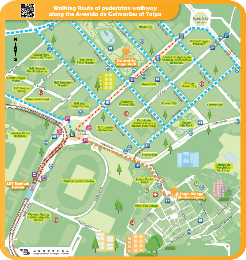
The updated version of “Walking Routes Map” added the walking route map of the pedestrian walkway along the Avenida de Guimarães of Taipa, introducing the walking route and the required walking time between the Light Rapid Transit Stadium Station, Olympic Sports Centre, Central da Taipa Park and Taipa Village. At the same time, the route maps of Cheok Kun Pavilion Escalator and Walkway System, walking route between the Lakeside Garden and Taipa Houses and the Escalator and Walkway System at Baía de Nossa Senhora da Esperança are also updated, providing location information of various cross-district walking systems, pedestrian crossing facilities, car parks, bus stops, taxi stops and light rail stations, so that the citizens can walk to various districts in a safe, comfortable, convenient and time-saving way.
The citizens can browse the thematic website through computer or mobile device to learn about the above-mentioned walking route information and view the scenic spots along the routes through 360 panoramic photos. Using a mobile device to browse the “Walking Route Map” can also obtain the function of real-time location information, encouraging citizens to take ecological tours through geographic information technology. Citizens are welcome to visit the thematic website of walking routes by scanning the QR code below or entering the website address (https://routemap.dscc.gov.mo/en/).