 eTyphoonImg
Possible warning signals to be issued due to the impact on "Chaba"
Update Time: 2022-07-01 09:00
| Signals | Forecast Period | Probability |
| Typhoon Signal No.3 | In effect | |
| Typhoon Signal No.8 | Afternoon to nighttime on 1st July | Medium |
| "blue" Storm Surge Warning | Afternoon on 1st July | Relatively High |
| "yellow" Storm Surge Warning | Relatively low to medium | |
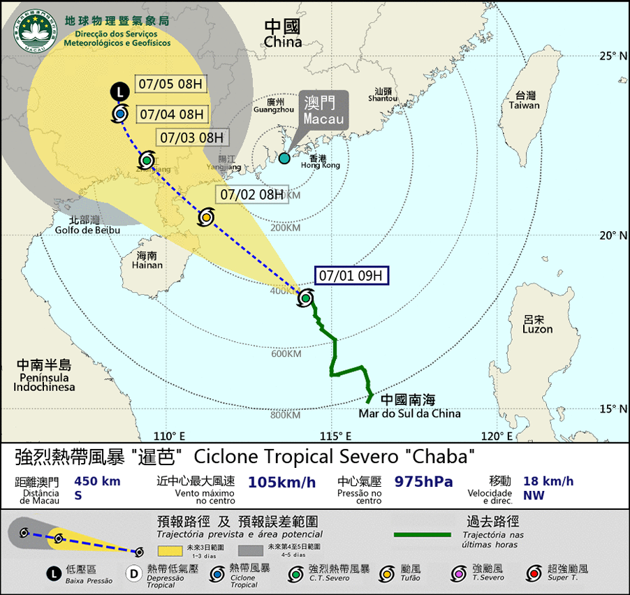
Severe tropical storm “Chaba” is expected to move NW and generally towards the area between the western coast of Guangdong and Hainan Island. Since another low pressure area is expected to develop at the ocean to the east of the Philippines, the intensity and the track of “Chaba” remains uncertain. If it takes a more northward track towards Macao, the possibility of issuing higher signals will increase.
Under the influence of the broad circulation of “Chaba”, its related rainband will bring unsettled weather to Macao. The winds will intensify, with frequent showers and thunderstorms from Friday(1st) to Sunday(3rd).
Meanwhile, as it is during the high phase of the astronomical tide, slightly flooding will occur between morning and noon on 1st. And under the combined influence of the storm surge and persisted rain, flooding below 0.5m is expected to occur on 2nd, between morning and noon.
SMG will closely monitor on its development. The public is advised to take precautions in advance and pay attention to the latest news.
Remarks: The probabilities of issuing severe weather warning signals for the next one or two days are provided in the table. Public can learn the possibility of being affected by the tropical cyclone over the specific period of time in Macao so that necessary precautions can be well prepared earlier. Please keep notice of our latest information.


